


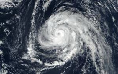
Sometime Wednesday, Hurricane Michael will come ashore on Florida’s Panhandle, bringing “potentially catastrophic” storm surge, winds and torrential rainfall that could make it one of the worst storms in Sunshine State history. It was upgraded early Wednesday to what the National Hurricane Center called an “extremely dangerous” Category 4 hurricane with maximum sustained winds of 130 mph
Where is Michael?
At 5 a.m., an Air Force Reserve Hurricane Hunter crew reported top sustained winds up to near 140 mph with higher gusts. Michael’s eye was about 140 miles from Panama City and 130 miles from Apalachicola. The storm is moving relatively fast at 13 mph. Tropical-storm force winds extending 185 miles from the center were already lashing the coast.
When will it make landfall?
On its current trajectory, Michael will make landfall on Wednesday, likely between 3-6 p.m., CNN reported Tuesday night.
Where will it make landfall?
It’ll be near Panama City, Florida, according to Accuweather. A resort city on the Gulf of Mexico and one of the jewels on Florida’s 300 miles of Panhandle coastline, Panama City has a population of nearly 40,000
What’s the storm surge forecast?
The danger of Michael’s storm surge increased on Tuesday, with 9- to 13-foot surges predicted in some areas of Florida, according to the hurricane center. A storm surge warning is in place for the border of Okaloosa and Walton counties to the Anclote River.
How strong are the winds?
Michael had maximum sustained winds of 140 mph, and the hurricane center warned that “additional strengthening is possible” ahead of landfall.